Canada Goose wrote: ↑Fri Aug 23, 2019 9:15 am
Ya, as you say, Point Atkinson was garbage...
Merry Island has a mean temperature of 11.0C, so Sumas Canal (pretty good station but a lot of data are missing) is warmer.
Anyway, it's very important to know how each station is located in order to make comparison.
I've already posted Castlegar photo on page 3.
Fantastic photos guy's weather station (porn) get's me excited. talking about point Atkinson, I can remember when it was a manned station I came to know the station master those where the day's indeed. The actual wind readings were radioed into Victoria coast guard radio I believe, I actually got to radio in an observation during a visit, even the fog horn was turned on if the visibility dropped to a certain point now it's all automated what a joke. I think Mr. Nimbus-cile would have good insight into manned stations back in the day. And as for Sumas Canal it's a bad location it's up against a mountain off of highway 1 not very exposed at all another joke.
The 6th annual alzheimer's snowfall contest Canoodles record: 44-18-8 Wrinkle Rockers: 43cm South Sardines: 57cm
CYCW station https://cycw.awos.live/local-weather
Merritt the automated station is a much better location. Yes it is it's at the rest stop at the bottom of the Highway 5 just before the turn off to the connector we always stop there for a pee and a delicious ice cream bar from the stand there. That way I can stare in awe at the weather station, it's in a bad location for wind only a couple of directions can blow but it's usually a hot wind through there.
The 6th annual alzheimer's snowfall contest Canoodles record: 44-18-8 Wrinkle Rockers: 43cm South Sardines: 57cm
CYCW station https://cycw.awos.live/local-weather
Here's the Merritt auto station by the Highway 5 rest stop, I'm not sure if the readings are available on Drivebc.ca or not and the rest stop we always stop at and I'm sure members on here have as well.
You do not have the required permissions to view the files attached to this post.
The 6th annual alzheimer's snowfall contest Canoodles record: 44-18-8 Wrinkle Rockers: 43cm South Sardines: 57cm
CYCW station https://cycw.awos.live/local-weather
I know it's not an E.C. station but I find the highway stations interesting as well, some are in bad locations, maybe do a montage of highway weather stations too.
The 6th annual alzheimer's snowfall contest Canoodles record: 44-18-8 Wrinkle Rockers: 43cm South Sardines: 57cm
CYCW station https://cycw.awos.live/local-weather
Sardisbcwx wrote: ↑Sat Aug 24, 2019 1:19 amAnd as for Sumas Canal it's a bad location it's up against a mountain off of highway 1 not very exposed at all another joke.
Sardisbcwx wrote: ↑Sat Aug 24, 2019 1:28 am
Merritt the automated station is a much better location. Yes it is it's at the rest stop at the bottom of the Highway 5 just before the turn off to the connector we always stop there for a pee and a delicious ice cream bar from the stand there. That way I can stare in awe at the weather station, it's in a bad location for wind only a couple of directions can blow but it's usually a hot wind through there.
Is that the forestry station?
I remember when every small town had a forestry office, and they had real manned EC weather stations. Even the town I grew up in with a mere 150 people had a forestry office until everything was centralized to Alexis Creek in the 1980s. Then when El Gordo became Premier, forestry offices were further centralized to Williams lake (for the Cariboo-Chilcotin district).
As for the rest stop, it no longer exists. The Powers-That-Be decided to close it down and spend a few extra million of your tax dollars to build new a rest stop on some God forsaken section of the Okanagan Connector instead.
Sardisbcwx wrote: ↑Sat Aug 24, 2019 1:19 am And as for Sumas Canal it's a bad location it's up against a mountain off of highway 1 not very exposed at all another joke.
It doesn't look that bad to me. Try not having a weather station that lose to the hill in the Fraser canyon or even the Okanagan!
Canada Goose wrote: ↑Mon Aug 26, 2019 7:45 am
Could be...
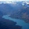
The interesting thing about Peachland is that it has the warmest winters anywhere in the Okanagan valley, even warmer than Osoyoos. This is likely due to the moderate effect of Okanagan Lake.
Glacier wrote: ↑Mon Aug 26, 2019 10:00 am
The interesting thing about Peachland is that it has the warmest winters anywhere in the Okanagan valley, even warmer than Osoyoos. This is likely due to the moderate effect of Okanagan Lake.
Considering the average Tmin, the Peachland weather station must be at the top of a hill.
The Yukon has been gutted of weather stations over the past 20 years or so such that the only ones left tend to be at airports. There are FEWER than 20 weather stations in the entire territory now, but at least they are all really well situated as far as I can tell.
Dawson:
dawsonWS1.png
dawsonws2.png
Old Crow (fly-in community only, and the most northern community in the Yukon... also, no alcohol allowed)
oldcrowWS1.png
Whitehorse (interesting how there's no fence around the station):
WhitehorseWS1.png
WhitehorseWS2.png
Watson Lake (not exactly sure the location here):
WatsonLakeWS.png
You do not have the required permissions to view the files attached to this post.
Last edited by Glacier on Mon Aug 26, 2019 3:21 pm, edited 3 times in total.


 Canoodles record: 44-18-8
