December 2021 Forecasts And Discussions
-
Canada Goose

- Weather Enthusiast

- Posts: 2209
- Joined: Mon Feb 18, 2019 12:41 pm
- Location: Port Coquitlam (Downtown) - Banana Belt
- Elevation: 11 m
- Has thanked: 741 times
- Been thanked: 4551 times
Re: December 2021 Forecasts And Discussions
My Twitter/X account: https://twitter.com/ThierryGooseBC
-
WeatherPro

- Weather Tracker

- Posts: 185
- Joined: Wed Feb 20, 2019 1:52 pm
- Location: Edmonton
- Has thanked: 317 times
- Been thanked: 1662 times
Re: December 2021 Forecasts And Discussions
Good day all, how was your snowfall? I see my predictions were spot on this time. I was starting to lose faith in myself.
A good helping of 15CM to 20Cm fell across the entire south coast. They system delivered with an overly fat abundance of powdery light snow.
Now onto more important things.
Friday night, into Saturday and possibly beyond is looking like a massive snowstorm potential of epic proportions.
The scene:
Very cold air still trapped in all of SW BC. System dropping out of the North and sliding down over BC.
Models overdoing the warm-up, almost guaranteed at this point. (If this system was coming out of the south west,then it would be more clear).
Ground temps are frozen very well, river temps, and water body temps are at or below freezing. Excellent ice coverage on lakes and even the Fraser River. Another clear night tonight should lower temps pretty good and as cloud cover rolls in Friday hopefully, most likely the cold temps will be held in. Almost everything is on par for snow.
Now, the system is a bit warmer, so there may be some low level sea elevation that will see a transition at some point on Sunday. My feeling is this will NOT turn to rain at higher elevations, like Burnaby, Surrey, Fraser Valley. The usual suspects.
It will start as snow at sea level as well. Wet bulb will play a role.
The uncertain part of this is there is a high chance some areas will not transition to rain, and remain snow until Monday when the temps start to drop again and snow is even more likely. This will be riding the edge for sure. So many dynamics at play that are NOT normal in these situations.
My forecast, simplified. Friday Night and Saturday will see snow at all elevations. Heavy snow. Possible amounts 20CM lower elevations and to 40CM at higher elevations and inland going into Sunday. Now IF this turns out to be all snow, these amounts will verify easily over the 2.5 days. Then Monday comes with another storm that looks like it could run into Tuesday bringing another 20Cm or more!
It really is amazing the possibilities we are at right now. This could be the winter storm that puts that Victoria storm in second place if there is NO transition over the next few days. So keep that in mind. Again, "IF"
We all know there is a possibility of a bust, but at this point it could go wither way.
This coming week looks excellent for snow lovers. Some people could end up having a combined snow cover total of over 60CM! (Combined) <- Key word.
*This is a region wide event, in fact much of western BC will feel the impacts
EXCITING!
Last edited by WeatherPro on Thu Dec 30, 2021 3:54 pm, edited 1 time in total.
-
Forrest Gump

- Weather Enthusiast
- Posts: 4325
- Joined: Sun Feb 17, 2019 3:11 pm
- Location: South Surrey/White Rock
- Elevation: 377 Ft. or 115 M
- Has thanked: 12247 times
- Been thanked: 7911 times
Re: December 2021 Forecasts And Discussions
Yeah , kinda getting tired of people saying they prefer rain because "at least you don't have to shovel it".wetcoast91 wrote: ↑Thu Dec 30, 2021 3:16 pm Sick and tired of people saying they have lived in the Lower Mainland and have never seen ice on the Fraser River or frozen lakes.
It happens every 5 years. 2008, 2012, 2017, 2019, 2021. Used to happen moee frequently.
Or " Man is it cold , this dampness is going right through me , +8 on the wet coast feels much colder than -8 on the prairie".
Gumperoni 43cm
Sardineski 47cm
Sardineski 47cm
-
WeatherPro
- Weather Tracker
- Posts: 185
- Joined: Wed Feb 20, 2019 1:52 pm
- Location: Edmonton
- Has thanked: 317 times
- Been thanked: 1662 times
-
Hawk
- Storm Chaser

- Posts: 6626
- Joined: Mon Feb 18, 2019 6:45 pm
- Location: Langley/The Similkameeeens
- Elevation: 320/3024
- Has thanked: 11449 times
- Been thanked: 5845 times
Re: December 2021 Forecasts And Discussions
Epic Headline WP!! 
" Possible Massive Crippling Snow Storm Starting Friday Night "


"
Let's hope this April brings some ~24c sunny days. Yesssss 
Willoughby Langley at ~320ft / Similkameeeens ~3400ft
Willoughby Langley at ~320ft / Similkameeeens ~3400ft
-
wetcoast91

- Storm Chaser
- Posts: 5932
- Joined: Sun Feb 17, 2019 3:12 pm
- Location: New Westminster
- Elevation: 106m
- Has thanked: 5851 times
- Been thanked: 13336 times
Re: December 2021 Forecasts And Discussions
Forrest Gump wrote: ↑Thu Dec 30, 2021 3:49 pm Yeah , kinda getting tired of people saying they prefer rain because "at least you don't have to shovel it".
Or " Man is it cold , this dampness is going right through me , +8 on the wet coast feels much colder than -8 on the prairie".
Last edited by wetcoast91 on Thu Dec 30, 2021 3:56 pm, edited 1 time in total.
-
Hawk
- Storm Chaser
- Posts: 6626
- Joined: Mon Feb 18, 2019 6:45 pm
- Location: Langley/The Similkameeeens
- Elevation: 320/3024
- Has thanked: 11449 times
- Been thanked: 5845 times
Re: December 2021 Forecasts And Discussions
Yes WP  ...and it would only make sense that this event ends up all snow, as we have been getting pummmbled and hammmered with extreme weather events this year..so why not get totally buried in snow in the dead of winter? This would definitely make you the TLWP(The Legendary) if (at least)the local hills gets slammed with massive snow amounts(with little/no rain). Bring it on...for one time!
Let's hope this April brings some ~24c sunny days. Yesssss
Willoughby Langley at ~320ft / Similkameeeens ~3400ft
Willoughby Langley at ~320ft / Similkameeeens ~3400ft
-
Hawk
- Storm Chaser
- Posts: 6626
- Joined: Mon Feb 18, 2019 6:45 pm
- Location: Langley/The Similkameeeens
- Elevation: 320/3024
- Has thanked: 11449 times
- Been thanked: 5845 times
Re: December 2021 Forecasts And Discussions
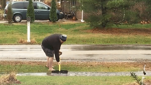
This is what Nito will be doing in March after the massive snowpack melt starts overflowing his ditches
Let's hope this April brings some ~24c sunny days. Yesssss
Willoughby Langley at ~320ft / Similkameeeens ~3400ft
Willoughby Langley at ~320ft / Similkameeeens ~3400ft
-
Bc_trucker
- Weather Tracker
- Posts: 183
- Joined: Sun Oct 06, 2019 10:54 pm
- Location: Chilliwack
- Elevation: 15 M.
- Has thanked: 604 times
- Been thanked: 708 times
Re: December 2021 Forecasts And Discussions
So what about the freezing rain aspect? Is that risk gone now, or should we still keep this in the back of our minds here in the Fraser Valley?....guess Weatherpro is gone now but maybe on of our other pro's can chime in on this?


East Chilliwack/Rosedale 15m
-
Rubus_Leucodermis

- Weather Enthusiast
- Posts: 4967
- Joined: Thu Nov 21, 2019 5:48 pm
- Location: Vancouver
- Elevation: 70 m / 230 ft
- Has thanked: 4131 times
- Been thanked: 9681 times
Re: December 2021 Forecasts And Discussions
100% agree. This is a situation fraught with possibility. The key word being possibility.WeatherPro wrote: ↑Thu Dec 30, 2021 3:43 pm
Good day all, how was your snowfall? I see my predictions were spot on this time. I was starting to lose faith in myself.
A good helping of 15CM to 20Cm fell across the entire south coast. They system delivered with an overly fat abundance of powdery light snow.
Now onto more important things.
Friday night, into Saturday and possibly beyond is looking like a massive snowstorm potential of epic proportions.
The scene:
Very cold air still trapped in all of SW BC. System dropping out of the North and sliding down over BC.
Models overdoing the warm-up, almost guaranteed at this point. (If this system was coming out of the south west,then it would be more clear).
Ground temps are frozen very well, river temps, and water body temps are at or below freezing. Excellent ice coverage on lakes and even the Fraser River. Another clear night tonight should lower temps pretty good and as cloud cover rolls in Friday hopefully, most likely the cold temps will be held in. Almost everything is on par for snow.
Now, the system is a bit warmer, so there may be some low level sea elevation that will see a transition at some point on Sunday. My feeling is this will NOT turn to rain at higher elevations, like Burnaby, Surrey, Fraser Valley. The usual suspects.
It will start as snow at sea level as well. Wet bulb will play a role.
The uncertain part of this is there is a high chance some areas will not transition to rain, and remain snow until Monday when the temps start to drop again and snow is even more likely. This will be riding the edge for sure. So many dynamics at play that are NOT normal in these situations.
My forecast, simplified. Friday Night and Saturday will see snow at all elevations. Heavy snow. Possible amounts 20CM lower elevations and to 40CM at higher elevations and inland going into Sunday. Now IF this turns out to be all snow, these amounts will verify easily over the 2.5 days. Then Monday comes with another storm that looks like it could run into Tuesday bringing another 20Cm or more!
It really is amazing the possibilities we are at right now. This could be the winter storm that puts that Victoria storm in second place if there is NO transition over the next few days. So keep that in mind. Again, "IF"
We all know there is a possibility of a bust, but at this point it could go wither way.
This coming week looks excellent for snow lovers. Some people could end up having a combined snow cover total of over 60CM! (Combined) <- Key word.
*This is a region wide event, in fact much of western BC will feel the impacts
EXCITING!
It's called clown range for a reason.
-
Typeing3

- Weather Psycho

- Posts: 12113
- Joined: Sun Feb 17, 2019 3:02 pm
- Location: Coquitlam
- Elevation: 25M./80Ft.
- Has thanked: 20206 times
- Been thanked: 22657 times
-
Forrest Gump
- Weather Enthusiast
- Posts: 4325
- Joined: Sun Feb 17, 2019 3:11 pm
- Location: South Surrey/White Rock
- Elevation: 377 Ft. or 115 M
- Has thanked: 12247 times
- Been thanked: 7911 times
Re: December 2021 Forecasts And Discussions
Obviously he's doing it for the exercise , only a nincompoop would toss it back into the same puddle.
Gumperoni 43cm
Sardineski 47cm
Sardineski 47cm
-
Typeing3
- Weather Psycho
- Posts: 12113
- Joined: Sun Feb 17, 2019 3:02 pm
- Location: Coquitlam
- Elevation: 25M./80Ft.
- Has thanked: 20206 times
- Been thanked: 22657 times
Re: December 2021 Forecasts And Discussions
Risk is definitely still there.Bc_trucker wrote: ↑Thu Dec 30, 2021 3:59 pm So what about the freezing rain aspect? Is that risk gone now, or should we still keep this in the back of our minds here in the Fraser Valley?....guess Weatherpro is gone now but maybe on of our other pro's can chime in on this?
East Coquitlam
Elevation 25M (80Ft)
#MrJanuary
-
Hawk
- Storm Chaser
- Posts: 6626
- Joined: Mon Feb 18, 2019 6:45 pm
- Location: Langley/The Similkameeeens
- Elevation: 320/3024
- Has thanked: 11449 times
- Been thanked: 5845 times
Re: December 2021 Forecasts And Discussions
Temps just plummeted in Abby, due to the absence of the apparently higher sun angles, which have now disappeared behind the clouds 
Let's hope this April brings some ~24c sunny days. Yesssss
Willoughby Langley at ~320ft / Similkameeeens ~3400ft
Willoughby Langley at ~320ft / Similkameeeens ~3400ft
-
wetcoast91
- Storm Chaser
- Posts: 5932
- Joined: Sun Feb 17, 2019 3:12 pm
- Location: New Westminster
- Elevation: 106m
- Has thanked: 5851 times
- Been thanked: 13336 times
Re: December 2021 Forecasts And Discussions
We are losing the outflow when the wind turns southerly with the passage of a weak front on Saturday evening. This is before the main precip arrives. GFS is the only model that keeps a weak outflow going hence the potential for brief freezing rain.Bc_trucker wrote: ↑Thu Dec 30, 2021 3:59 pm So what about the freezing rain aspect? Is that risk gone now, or should we still keep this in the back of our minds here in the Fraser Valley?....guess Weatherpro is gone now but maybe on of our other pro's can chime in on this?
I may be wrong but I see Sunday being rather wet with heavy rain and temps between +4 to +7 with the exception being Hope. Ponding and local flooding may be an issue.
My outlook sucks. Just go with WeatherPro's!