Can it be +10 and windy in southern sections and +0.5 with wet snow in northern sections at the same time? I'm not asking if it will happen (pretty much impossible to predict), just if it's geographically possible.wetcoast91 wrote: ↑Sat Jan 01, 2022 4:34 pm You get the South of Fraser special with Southerly winds and temps up to +10C tomorrow.
January 2022 Forecasts and Discussions
-
VanCitySouth

- Weather Enthusiast

- Posts: 3922
- Joined: Sun Feb 17, 2019 2:21 pm
- Location: Vancouver (Langara)
- Elevation: 72 m/236 ft
- Has thanked: 4164 times
- Been thanked: 8316 times
Re: January 2022 Forecasts and Discussions
2025-26 season stats:
Climo ∞ to 0.5
  GFS
GFS
Season total: 0.5 cm and TWO traces!
Peak depth: 0.5 cm (01/07/2026)
Climo
Season total: 0.5 cm and TWO traces!
Peak depth: 0.5 cm (01/07/2026)
-
wetcoast91

- Storm Chaser

- Posts: 7098
- Joined: Sun Feb 17, 2019 3:12 pm
- Location: New Westminster
- Elevation: 106m
- Has thanked: 6962 times
- Been thanked: 16338 times
Re: January 2022 Forecasts and Discussions
March 2014. I think South Surrey was +7C and Vancouver was near 0.5C with heavy wet snow.VanCitySouth wrote: ↑Sat Jan 01, 2022 4:36 pm Can it be +10 and windy in southern sections and +0.5 with wet snow in northern sections at the same time? I'm not asking if it will happen (pretty much impossible to predict), just if it's geographically possible.
-
VanCitySouth
- Weather Enthusiast
- Posts: 3922
- Joined: Sun Feb 17, 2019 2:21 pm
- Location: Vancouver (Langara)
- Elevation: 72 m/236 ft
- Has thanked: 4164 times
- Been thanked: 8316 times
Re: January 2022 Forecasts and Discussions
Just to break the theme of the Sunday to Tuesday banter about mild rain vs snow, what do you make of the surprising model consistency (both run to run AND across different agencies) about Wednesday night? Especially considering the large discrepancies leading up to what looks like an identical result?wetcoast91 wrote: ↑Sat Jan 01, 2022 4:38 pm March 2014. I think South Surrey was +7C and Vancouver was near 0.5C with heavy wet snow.
2025-26 season stats:
Climo ∞ to 0.5 GFS
Season total: 0.5 cm and TWO traces!
Peak depth: 0.5 cm (01/07/2026)
Climo
Season total: 0.5 cm and TWO traces!
Peak depth: 0.5 cm (01/07/2026)
-
SnowGeek11
- Cloud Watcher

- Posts: 91
- Joined: Tue Nov 23, 2021 12:42 pm
- Location: West Vancouver
- Elevation: 24 M./79 ft.
- Has thanked: 335 times
- Been thanked: 273 times
Re: January 2022 Forecasts and Discussions
-
wetcoast91
- Storm Chaser
- Posts: 7098
- Joined: Sun Feb 17, 2019 3:12 pm
- Location: New Westminster
- Elevation: 106m
- Has thanked: 6962 times
- Been thanked: 16338 times
Re: January 2022 Forecasts and Discussions
Most models are in agreement with the Sun-Tues progression at the 500mb level. Some struggle with the micro features such as the erosion of cold air or pressure gradients (wind) but it's otherwise uniform.VanCitySouth wrote: ↑Sat Jan 01, 2022 4:40 pm Just to break the theme of the Sunday to Tuesday banter about mild rain vs snow, what do you make of the surprising model consistency (both run to run AND across different agencies) about Wednesday night? Especially considering the large discrepancies leading up to what looks like an identical result?
EC seems to be going with a hybrid forecast based off climo + modeling output.
-
Typeing3

- Weather Psycho

- Posts: 14198
- Joined: Sun Feb 17, 2019 3:02 pm
- Location: Coquitlam
- Elevation: 25M./80Ft.
- Has thanked: 26799 times
- Been thanked: 28396 times
Re: January 2022 Forecasts and Discussions
Currently -1.3c, dp -4.8c here.
East Coquitlam
Elevation 25M (80Ft)
#MrJanuary
-
Hawk

- Total Weather Geek

- Posts: 8632
- Joined: Mon Feb 18, 2019 6:45 pm
- Location: Langley-Willoughby/The Similkameeeens
- Elevation: 100m/950m
- Has thanked: 17154 times
- Been thanked: 8329 times
Re: January 2022 Forecasts and Discussions
Or...we get a slushy 1cm and then rain and mild temps. I've seen that story before too many times as well, especially when there's been a snowfall warning up. I think EC is just playing it safe and covering their bases they don't want another natural disaster with government hands covered in blood 
Looking forward to our first 3 day stretch of sun and 20c++ 
Willoughby Langley at ~320ft / Similkameeeens ~3400ft
Willoughby Langley at ~320ft / Similkameeeens ~3400ft
-
VanCitySouth
- Weather Enthusiast
- Posts: 3922
- Joined: Sun Feb 17, 2019 2:21 pm
- Location: Vancouver (Langara)
- Elevation: 72 m/236 ft
- Has thanked: 4164 times
- Been thanked: 8316 times
Re: January 2022 Forecasts and Discussions
Okay that makes sense. Thank you. Sounds like apparently superficial details can make all the difference for 72 hours then.wetcoast91 wrote: ↑Sat Jan 01, 2022 4:47 pm Most models are in agreement with the Sun-Tues progression at the 500mb level. Some struggle with the micro features such as the erosion of cold air or pressure gradients (wind) but it's otherwise uniform.
EC seems to be going with a hybrid forecast based off climo + modeling output.
Last edited by VanCitySouth on Sat Jan 01, 2022 4:53 pm, edited 1 time in total.
2025-26 season stats:
Climo ∞ to 0.5 GFS
Season total: 0.5 cm and TWO traces!
Peak depth: 0.5 cm (01/07/2026)
Climo
Season total: 0.5 cm and TWO traces!
Peak depth: 0.5 cm (01/07/2026)
-
Macster

- Weather Tracker

- Posts: 184
- Joined: Sun Feb 17, 2019 2:19 pm
- Location: Eastern Cloverdale
- Elevation: 26m/85Ft
- Has thanked: 8 times
- Been thanked: 507 times
Re: January 2022 Forecasts and Discussions
Yeah! Warm rain and flooding. Come on!.... No wait, that's badwetcoast91 wrote: ↑Sat Jan 01, 2022 4:34 pm You get the South of Fraser special with Southerly winds and temps up to +10C tomorrow.
Personal Weather Station - https://www.wunderground.com/personal-w ... =ISURREY35
-
Hawk
- Total Weather Geek
- Posts: 8632
- Joined: Mon Feb 18, 2019 6:45 pm
- Location: Langley-Willoughby/The Similkameeeens
- Elevation: 100m/950m
- Has thanked: 17154 times
- Been thanked: 8329 times
Re: January 2022 Forecasts and Discussions
Ya but didnt Vanc just not have the S winds yet? Eventually they rolled in a little later? I'm sure temps spiked shortly after.wetcoast91 wrote: ↑Sat Jan 01, 2022 4:38 pm March 2014. I think South Surrey was +7C and Vancouver was near 0.5C with heavy wet snow.
Looking forward to our first 3 day stretch of sun and 20c++
Willoughby Langley at ~320ft / Similkameeeens ~3400ft
Willoughby Langley at ~320ft / Similkameeeens ~3400ft
-
PortKells

- Storm Chaser
- Posts: 7726
- Joined: Sun Feb 17, 2019 4:08 pm
- Location: Port Kells
- Elevation: 78m
- Has thanked: 589 times
- Been thanked: 13671 times
Re: January 2022 Forecasts and Discussions
The mid week system.
You do not have the required permissions to view the files attached to this post.
-
Hawk
- Total Weather Geek
- Posts: 8632
- Joined: Mon Feb 18, 2019 6:45 pm
- Location: Langley-Willoughby/The Similkameeeens
- Elevation: 100m/950m
- Has thanked: 17154 times
- Been thanked: 8329 times
Re: January 2022 Forecasts and Discussions
EC has already changed the tune for Sunday Pitt Meadows. Now its Snow over higher terrain all day
Sounds like 300m snow levels to me up against the hills with cold air damming
Looking forward to our first 3 day stretch of sun and 20c++
Willoughby Langley at ~320ft / Similkameeeens ~3400ft
Willoughby Langley at ~320ft / Similkameeeens ~3400ft
-
Radar
- Weather Fanatic

- Posts: 891
- Joined: Sun Feb 17, 2019 7:23 pm
- Location: West Abbotsford
- Elevation: 290ft
- Has thanked: 39 times
- Been thanked: 1667 times
Re: January 2022 Forecasts and Discussions
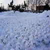
The Fraser today. Langley Abbotsford border area.
You do not have the required permissions to view the files attached to this post.
West Abby. Elev. 290ft
PWS: https://www.wunderground.com/dashboard/pws/IABBOT57/
24/25 snow total: 29cm
PWS: https://www.wunderground.com/dashboard/pws/IABBOT57/
24/25 snow total: 29cm
-
Hawk
- Total Weather Geek
- Posts: 8632
- Joined: Mon Feb 18, 2019 6:45 pm
- Location: Langley-Willoughby/The Similkameeeens
- Elevation: 100m/950m
- Has thanked: 17154 times
- Been thanked: 8329 times
Re: January 2022 Forecasts and Discussions
Squamish will disappear off the map this week. It will just be a big mound of white 
Looking forward to our first 3 day stretch of sun and 20c++
Willoughby Langley at ~320ft / Similkameeeens ~3400ft
Willoughby Langley at ~320ft / Similkameeeens ~3400ft
-
Wintergirl
- Weather Tracker
- Posts: 209
- Joined: Sun Feb 17, 2019 2:32 pm
- Location: Squamish
- Has thanked: 231 times
- Been thanked: 866 times
Re: January 2022 Forecasts and Discussions
Haha!!! I will take lots of photos, currently a few flakes falling!