I mentioned convection and thunder snow possibilities a few days ago. Sucks if it’s hail and graupel and not snow though.
February 2025 Forecasts And Discussions
-
Monty

- Weather Enthusiast

- Posts: 4575
- Joined: Sun Feb 17, 2019 2:56 pm
- Has thanked: 959 times
- Been thanked: 9576 times
Re: February 2025 Forecasts And Discussions
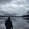
North end of Shawnigan Lake. Southern Vancouver island. 500ft
-
AbbyJr

- Storm Chaser

- Posts: 6606
- Joined: Sun Feb 17, 2019 2:14 pm
- Location: Abbotsford
- Elevation: 50m(164ft)
- Has thanked: 12860 times
- Been thanked: 12308 times
Re: February 2025 Forecasts And Discussions
You do not have the required permissions to view the files attached to this post.
Central Abbotsford
50m (164ft)
2022/23 season snowfall: 76.8cm


50m (164ft)
2022/23 season snowfall: 76.8cm
-
Typeing3

- Weather Psycho

- Posts: 14198
- Joined: Sun Feb 17, 2019 3:02 pm
- Location: Coquitlam
- Elevation: 25M./80Ft.
- Has thanked: 26799 times
- Been thanked: 28397 times
Re: February 2025 Forecasts And Discussions
Those heavy bands modeled on the HRDPS almost certainly look juicier due to convergence with the arctic front. It's a near impossible forecast.
East Coquitlam
Elevation 25M (80Ft)
#MrJanuary
-
Typeing3
- Weather Psycho
- Posts: 14198
- Joined: Sun Feb 17, 2019 3:02 pm
- Location: Coquitlam
- Elevation: 25M./80Ft.
- Has thanked: 26799 times
- Been thanked: 28397 times
Re: February 2025 Forecasts And Discussions
Agreed. I think the eastern Island will end up getting more snow than most of the Lower Mainland when this is all set an done. Will be easy to best my paltry 4cm total at the very least.
East Coquitlam
Elevation 25M (80Ft)
#MrJanuary
-
Cloverdale
- Weather Tracker

- Posts: 381
- Joined: Sun Feb 17, 2019 7:41 pm
- Has thanked: 2 times
- Been thanked: 868 times
-
Storm

- Storm Chaser
- Posts: 7094
- Joined: Sun Feb 17, 2019 2:09 pm
- Location: North Burnaby/Burquitlam
- Has thanked: 2493 times
- Been thanked: 12532 times
Re: February 2025 Forecasts And Discussions
SWS
Snow, blowing snow and Arctic outflow conditions
Where: Vancouver Island and Southern Gulf Islands, Sunshine Coast, Howe Sound, Whistler, Metro Vancouver, Fraser Valley.
When: Now into next week.
Remarks: A wintry mix of weather conditions is expected to impact the South Coast of BC over the next several days.
This weekend:
Heavy flurries and cold temperatures are expected this weekend as arctic air invades the region and an upper low brings the moisture. Be advised for sudden reduction in visibility in convective flurries if travelling around the South Coast. Accumulations are uncertain at this time as it will depend where the flurries develop but accumulating snow is likely in many areas this weekend. Snowfall warnings have been issued for regions with heavier snowfall.
Next week:
Very cold and dry air is expected over the South Coast with outflow conditions from an arctic ridge of high pressure settling over the region. Temperatures will be 5 to 8 degrees Celsius below seasonal. Blowing snow is possible through the Fraser Valley with recent snowfall. Watch for accumulating snow over eastern Vancouver Island from Qualicum Beach to the Saanich Peninsula early next week. Strong outflow winds will result in cold wind chills.
Please continue to monitor alerts and forecasts issued by Environment Canada. To report severe weather, send an email to BCstorm@ec.gc.ca or tweet reports using #BCStorm.
North Burnaby/Burquitlam
Elevation - 64 M./210 Feet
Elevation - 64 M./210 Feet
-
Hawk

- Total Weather Geek

- Posts: 8636
- Joined: Mon Feb 18, 2019 6:45 pm
- Location: Langley-Willoughby/The Similkameeeens
- Elevation: 100m/950m
- Has thanked: 17160 times
- Been thanked: 8330 times
Re: February 2025 Forecasts And Discussions
Heavy snow in Willoughby rn
Looking forward to our first 3 day stretch of sun and 20c++ 
Willoughby Langley at ~320ft / Similkameeeens ~3400ft
Willoughby Langley at ~320ft / Similkameeeens ~3400ft
-
Typeing3
- Weather Psycho
- Posts: 14198
- Joined: Sun Feb 17, 2019 3:02 pm
- Location: Coquitlam
- Elevation: 25M./80Ft.
- Has thanked: 26799 times
- Been thanked: 28397 times
Re: February 2025 Forecasts And Discussions
Front fully through the mountains and the inlets of the central coast. Currently -7.1c, dp -15.3c right at sea level at Bella Bella. Further inland at Bella Coola it's currently -11.9c, dp -24.4c.
East Coquitlam
Elevation 25M (80Ft)
#MrJanuary
-
tyweather

- Model Rider

- Posts: 1869
- Joined: Sun Feb 17, 2019 2:39 pm
- Location: Newton, Surrey, EL. 70m
- Has thanked: 84 times
- Been thanked: 4244 times
Re: February 2025 Forecasts And Discussions
Coming down hard in Newton with grauple
You do not have the required permissions to view the files attached to this post.
Why not try cycling to work, grocery store, anywhere!
-
PortKells

- Storm Chaser
- Posts: 7726
- Joined: Sun Feb 17, 2019 4:08 pm
- Location: Port Kells
- Elevation: 78m
- Has thanked: 589 times
- Been thanked: 13672 times
Re: February 2025 Forecasts And Discussions
I keep getting donuted despite promising looking radar. Starting to feel that impatience kick in... Let's go here! 

-
Weather101

- Storm Chaser
- Posts: 5647
- Joined: Fri Feb 22, 2019 7:27 am
- Location: Richmond
- Elevation: 3 Ft
- Has thanked: 5273 times
- Been thanked: 7888 times

-
PortKells
- Storm Chaser
- Posts: 7726
- Joined: Sun Feb 17, 2019 4:08 pm
- Location: Port Kells
- Elevation: 78m
- Has thanked: 589 times
- Been thanked: 13672 times
Re: February 2025 Forecasts And Discussions
Ok HRRR's got us.
You do not have the required permissions to view the files attached to this post.
-
Bc_trucker
- Weather Tracker
- Posts: 231
- Joined: Sun Oct 06, 2019 10:54 pm
- Location: Chilliwack
- Elevation: 15 M.
- Has thanked: 716 times
- Been thanked: 871 times
Re: February 2025 Forecasts And Discussions
Can see some blue skies here at the moment, some light snow on and off...wind is picking up
You do not have the required permissions to view the files attached to this post.
East Chilliwack/Rosedale 15m
-
ClaytonWx
- Cloud Watcher

- Posts: 80
- Joined: Mon Feb 18, 2019 4:26 pm
- Location: Clayton Heights, Surrey
- Elevation: 279ft
- Has thanked: 291 times
- Been thanked: 256 times
Re: February 2025 Forecasts And Discussions
Experiencing heavy graupel and reduced visibility as this cell moves across the farm lands south of Cloverdale
You do not have the required permissions to view the files attached to this post.